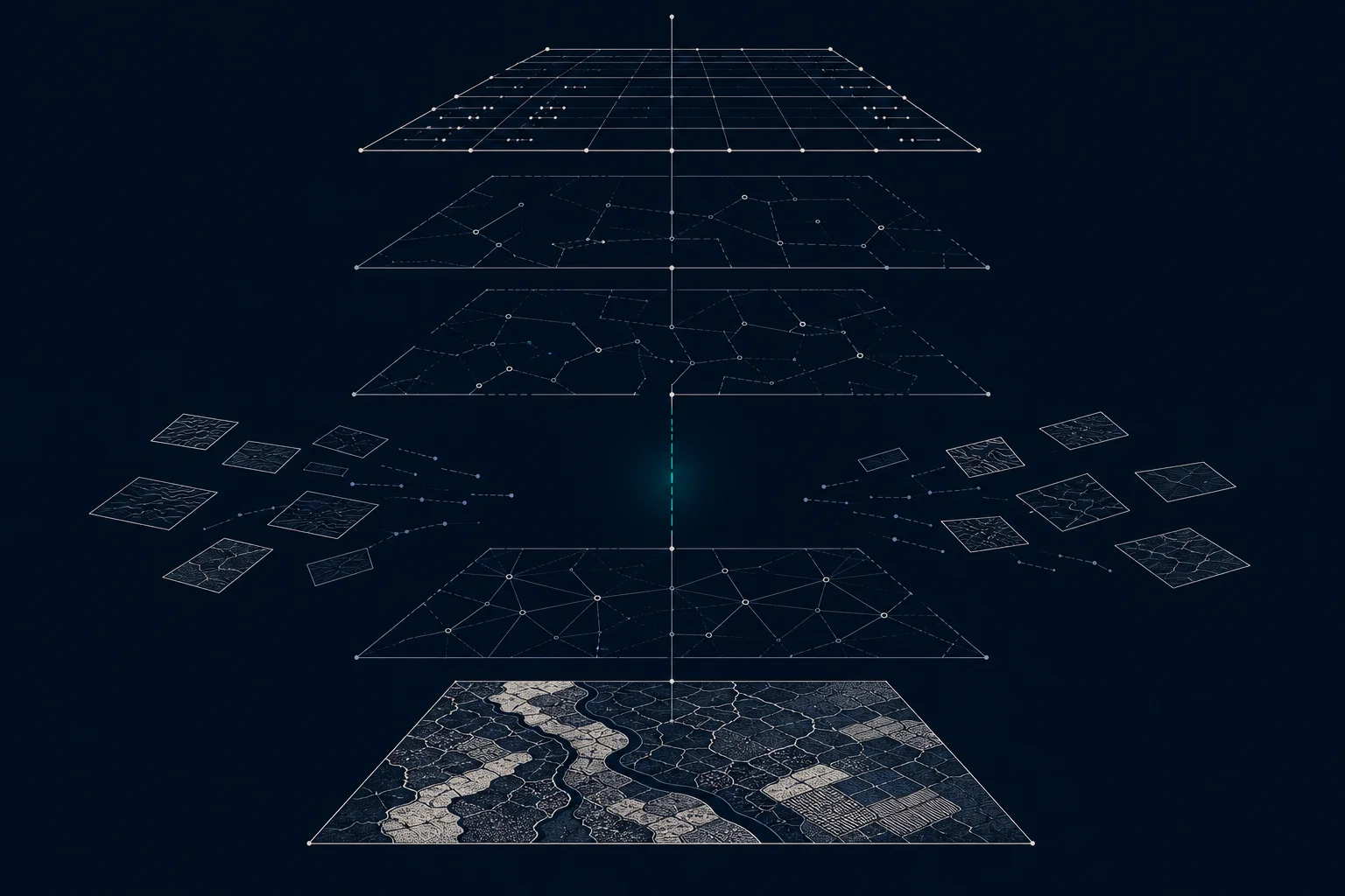
Every data leader who has funded geospatial work knows the pattern. The pilot goes well. The map is convincing, the metric is promising, the demo lands. Then months pass, and the thing that impressed everyone still is not running anywhere: no schedule, no owner, no table anyone can build on.
The stall is common enough to deserve a better explanation than the usual one, that geospatial is hard. Spatial data is genuinely demanding, but demanding workloads reach production every day. Something else is going on, and it is organizational as much as technical.
This article is about that something else: where the stall actually comes from, and what the teams that ship do differently.
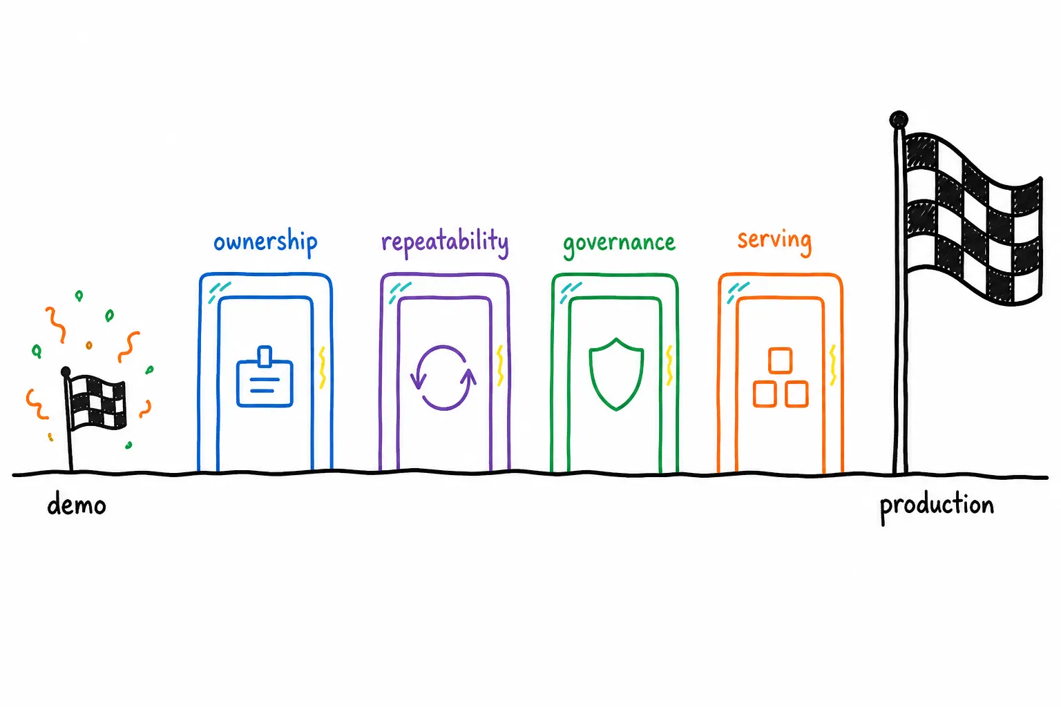
Between the demo and production stand the four deferred decisions: ownership, repeatability, governance, and serving.
What actually causes the stall?
Geospatial complexity is the usual explanation. Imagery is large, coordinate systems vary, providers revise archives, spatial joins can be expensive, and specialist libraries are required. Those constraints are real, and they rarely explain the whole delay.
The pattern underneath is simpler: a successful analysis gets mistaken for a production system. The team proves that source data and an algorithm can produce a useful result, then postpones decisions about ownership, repeatability, governance, cost, and serving. Those deferred decisions become the main work required for production.
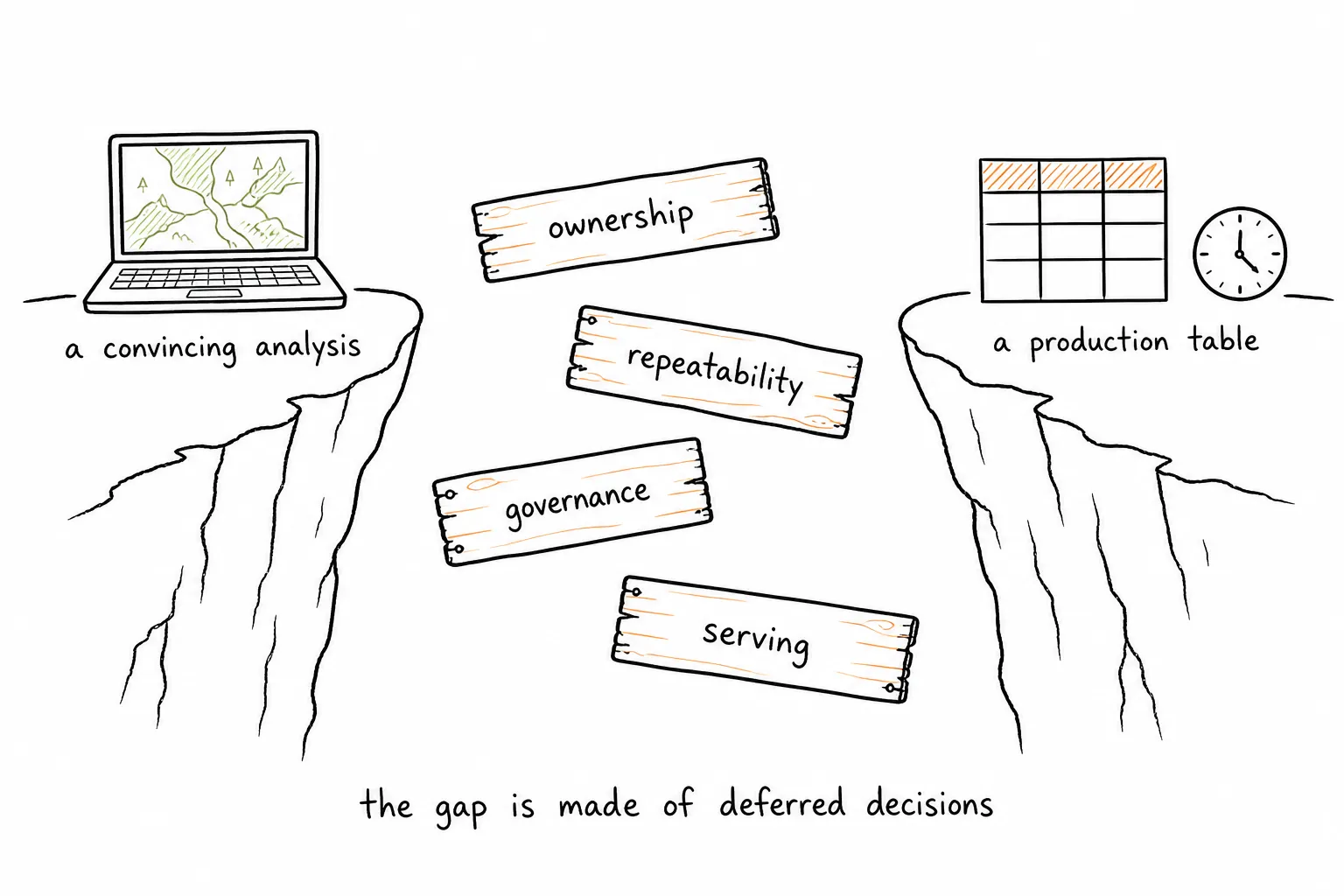
The gap between a convincing analysis and a production table is made of the decisions the team deferred.
The deeper issue is that spatial work often sits outside the engineering and governance practices used for other business data.
What must be defined before the technical choices?
A pipeline should begin with the decision its output will support. The team needs to name the consumer, output grain, refresh schedule, expected coverage, quality threshold, and acceptable delivery time. Without that contract, every technical choice remains provisional.
Consider a building-level wildfire exposure product. The phrase sounds specific, yet it leaves important questions open. Which building record supplies the identifier? Which observation period applies? How is exposure summarized across a footprint? What happens when imagery is obscured? Which result is current after a late source correction?
A notebook can choose temporary answers and display a convincing map. A production table must make those answers stable and reviewable. The implementation can change over time, while the output meaning remains controlled.
When should production work start?
Teams often schedule production engineering after exploratory work. That sequence creates avoidable redesign. Source retention, identifiers, partitioning, lineage, and validation affect the analysis itself. They should be addressed while the team is learning what the data can support.
Early production design does not require a large platform program. It requires a few explicit decisions. Preserve the provider files and manifests. Assign stable identifiers to source objects. Record coordinate reference systems and acquisition times. Define quality failures that stop publication. Write outputs to a location with an owner and a lifecycle policy.
These practices make experimentation more reliable. They also give engineers a clear path from a promising method to a repeatable job.
Where should geospatial work live in the organization?
Organizations often route spatial work to a geographic information system team and leave data platform engineers outside the process. The specialist team understands the data but may lack authority over production orchestration, catalogs, identity, or application infrastructure. The platform team owns those systems but sees geospatial as an exception.
That organizational boundary becomes a technical boundary. Files move through shared drives or ad hoc storage. Results are copied into business systems without complete lineage. Monitoring depends on the person who wrote the script. Access reviews cover the final table but miss intermediate data.
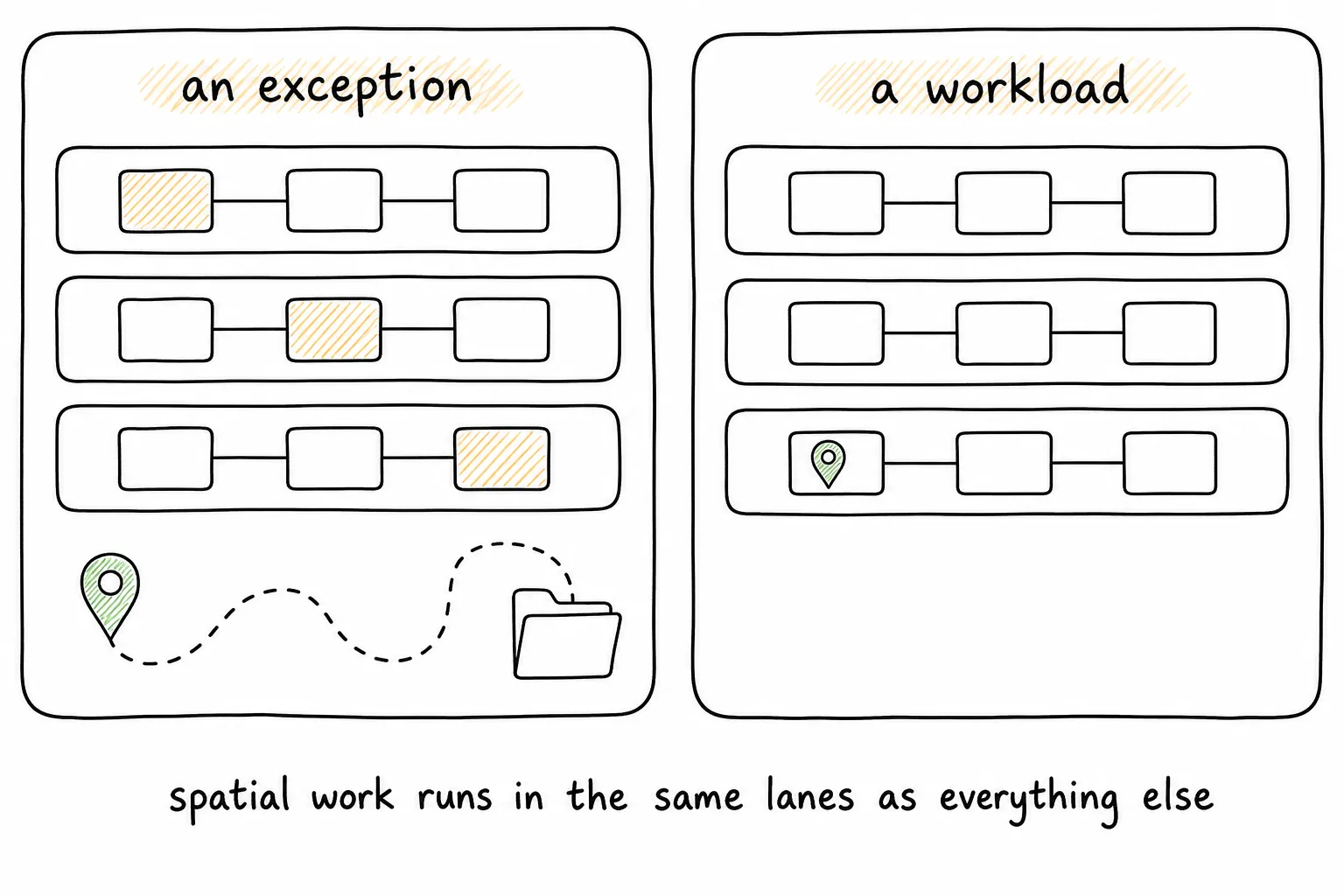
Treated as an exception, spatial work moves through side channels. Treated as a workload, it runs in the same lanes as everything else.
Treating geospatial as a workload changes the division of responsibility. Geospatial practitioners define spatial validity, suitable transformations, and domain-specific quality. Data engineers provide orchestration, deployment, observability, and table operations. Security and governance teams apply the controls already used across the primary data platform, the operating model of a geospatial lakehouse.
Specialist knowledge remains essential. The workload gains an operating home.
What does governance need to cover?
A governance diagram is useful only when it matches how bytes and records move. Raster pixels may remain in object storage while catalog tables hold footprints and metadata, the pattern described in How does raster data work in a lakehouse. A specialist engine may transform those files before derived values enter a managed table. An application may need a separate low-latency serving store.
Each boundary needs an owner, access policy, and lineage record. Teams should distinguish capabilities operated by the platform from workflows they operate themselves. This distinction determines who patches a library, responds to a failed job, controls cost, and validates a platform upgrade.
A claim that all data is governed because the final table is in a catalog leaves the earlier stages unresolved. Source data, intermediate states, and serving representations can contain sensitive or licensed information. Their controls need to be explicit.
How do you know a pipeline is ready for production?
A production pipeline should report what happened during every run. Useful evidence includes the source objects received, partitions completed, records rejected, output rows written, runtime, processing volume, and estimated cost. Checkpoints should let a failed run resume without repeating accepted work.
The team also needs representative performance tests. A demonstration over one city does not establish the cost of processing a country. A spatial index that accelerates one query pattern may slow another. Cloud architecture diagrams cannot settle these questions. Benchmarks using intended data volumes and geographic distributions can.
Operational evidence turns launch readiness into a decision based on observed behavior. It also gives the eventual operator a baseline for diagnosing change.
When is a pipeline actually delivered?
A pipeline has reached production when a named team can operate it under normal and failure conditions. That team needs the code in its repository, deployment instructions, data contracts, monitoring, known failure cases, recovery steps, and escalation ownership.
Handover should be tested. An engineer who did not build the pipeline should run it, inspect its output, and recover from a controlled failure. Gaps found during that exercise are delivery work.
Geospatial pipelines reach production when organizations treat them with the same discipline as other critical data workloads. The algorithms still matter. Reliable ownership and operation determine whether those algorithms become a durable business capability.
About the author
Sean Knight is a serial entrepreneur in the San Francisco Bay Area who builds products and companies around AI and geospatial data. He opened his first business, a retail computer shop, at 17, then began his career as an astrophysicist. From there he moved into remote sensing and machine learning, eventually flying drones over glaciers in Alaska and New Zealand to build 3D point clouds. Today he runs LakeGeo, consults on AI, and builds AI agents that run geospatial pipelines on platforms like Databricks. Find him on LinkedIn.
See more LakeGeo in your Google Search and AI results.
Make LakeGeo a preferred source on Google