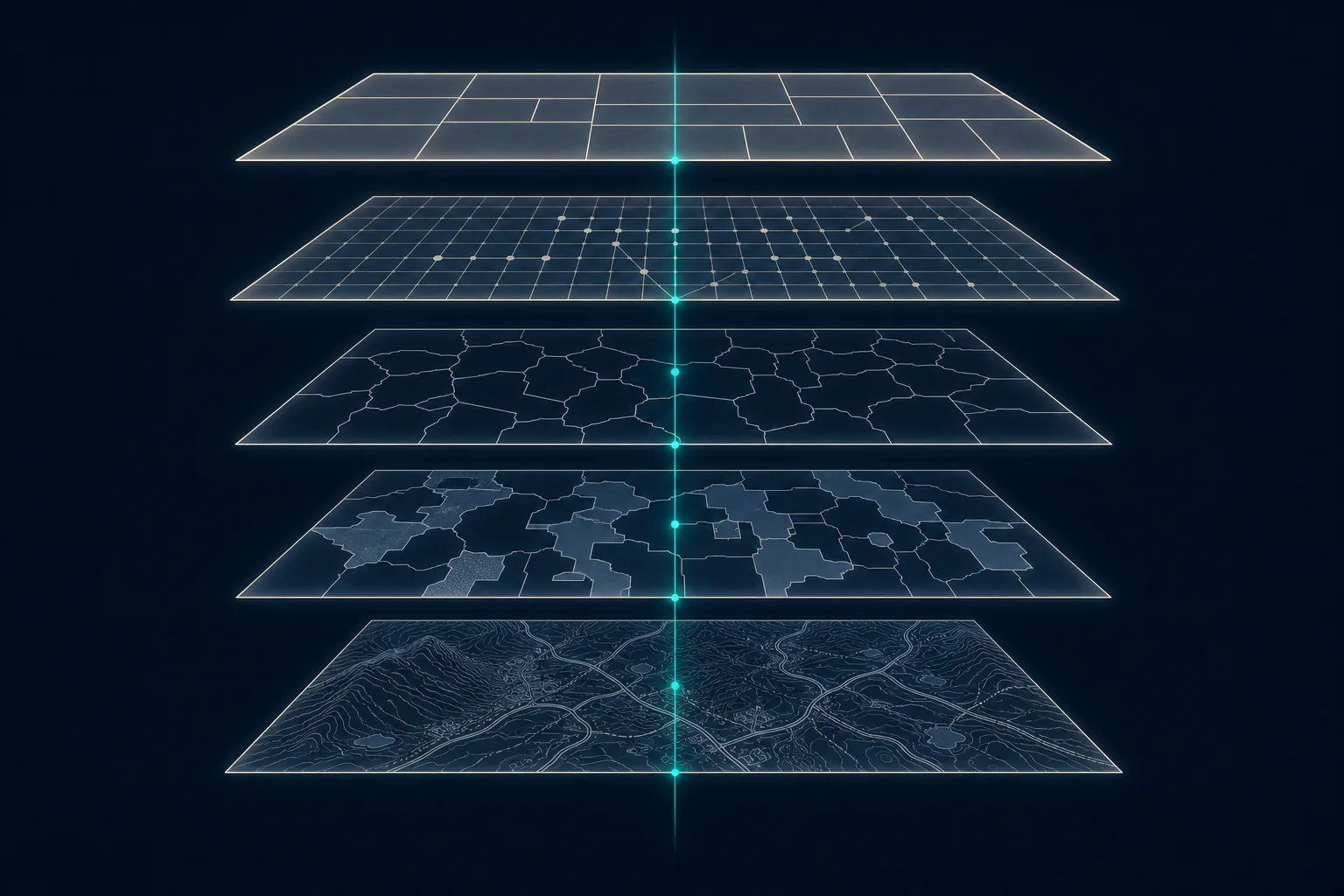
Most organizations have spent the past decade consolidating their data into governed platforms: one catalog, one set of access controls, one place where pipelines run and get monitored. Spatial data mostly sat this consolidation out. Imagery, parcel boundaries, movement records, and weather grids still tend to live in specialist tools at the edge of the data estate, connected to it by file exports and manual copies.
That separation has real costs. Spatial results reach business systems without lineage. Specialist pipelines run without the monitoring every other pipeline gets. And the questions spatial data answers, where the risk sits, what changed on the ground, which locations matter, are increasingly questions the whole business asks.
The geospatial lakehouse is the operating model that ends the separation. This guide defines it, explains the problem it solves, and describes what a production-ready implementation looks like.
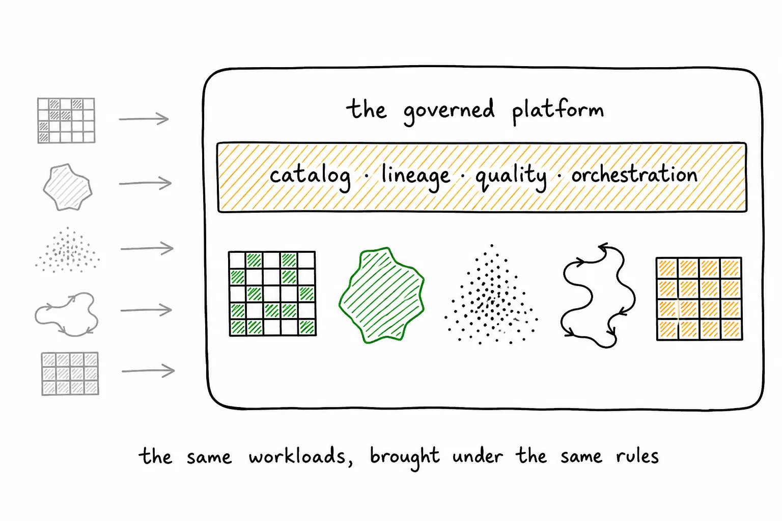
The whole idea in one drawing. The workloads stay what they are; what changes is that one governed platform now runs all of them.
What is a geospatial lakehouse?
Start from the workloads. Raster imagery, vector features, point clouds, movement records, environmental observations: each has its own formats and engines, and none of them stops being spatial by entering a general platform. A geospatial lakehouse is a governed data platform that treats all of them as production workloads, applying shared catalog, lineage, access control, quality, orchestration, and serving practices while retaining specialist geospatial engines when the primary platform lacks a required capability.
The term describes an operating model for spatial data. It does not require one vendor or one storage format. An implementation can combine object storage, managed tables, a warehouse, distributed compute, processing libraries, and specialist engines. The important requirement is that ownership and movement between those systems remain explicit.
What problem does a geospatial lakehouse solve?
Many teams process imagery, parcel data, weather observations, or movement records in a specialist environment, then copy selected results into a warehouse or application database. That division makes lineage, access control, quality review, and operational ownership harder to maintain, and it is the separation a geospatial lakehouse exists to remove.
Bringing spatial workloads into the primary data platform gives them the same operational foundation as customer, policy, asset, or supply-chain data. A risk score can be traced to the source imagery, processing date, model version, and business record it describes. A data engineer can monitor the pipeline through familiar tools. A security team can apply existing identity and access policies.
Which geospatial data belongs in the lakehouse?
The instinct is to draw a line: keep the tabular data in the platform and leave the difficult formats outside. The line turns out to be unnecessary. Raster imagery, vector features, point clouds, movement records, and environmental observations can all participate, each keeping the physical representation its processing needs.
Large raster scenes usually remain as files in object storage, the pattern covered in How does raster data work in a lakehouse. Governed tables hold their footprints, acquisition times, coordinate reference systems, quality measurements, and storage locations. Vector features can live directly in managed tables with geometry columns and spatial indexes. Point clouds may use partitioned files plus catalog tables. Movement data often uses time-partitioned tables with spatial keys.
The lakehouse provides a common control plane across those representations. It does not force every spatial object into a relational row.
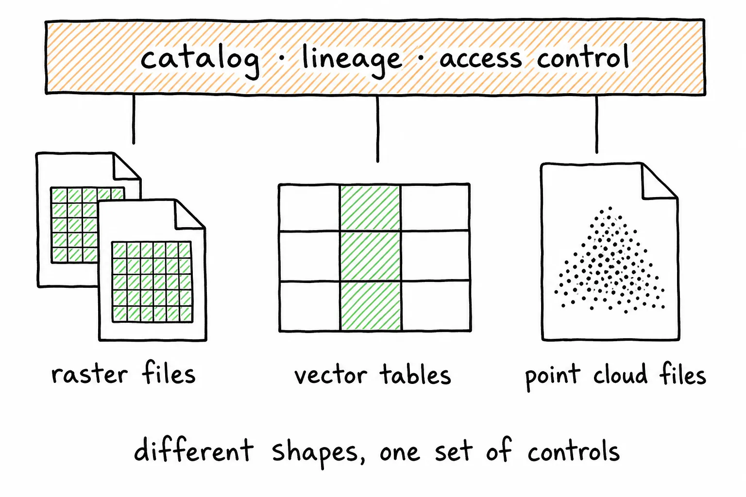
Different physical shapes, one set of controls. Each workload keeps its efficient representation while the platform governs all of them.
How is a geospatial lakehouse organized?
Organization follows from one demand: any published value must be reproducible from preserved sources and versioned processing logic. A practical implementation therefore separates source preservation, normalization, analysis-ready data, governed products, and serving representations. This staged flow is the geospatial lakehouse medallion architecture.
The source layer preserves provider files and delivery metadata. The normalization layer validates formats, coordinate systems, timestamps, and identifiers. Analysis-ready data aligns imagery or features to a repeatable spatial scheme and records quality checks. Governed products express a stable business meaning, such as building-level wildfire exposure for a stated period. Serving representations support a particular consumer, such as an analyst, model, map, API, or partner.
A table should identify the source objects and code version that produced each release. That requirement matters more than the names assigned to the layers.
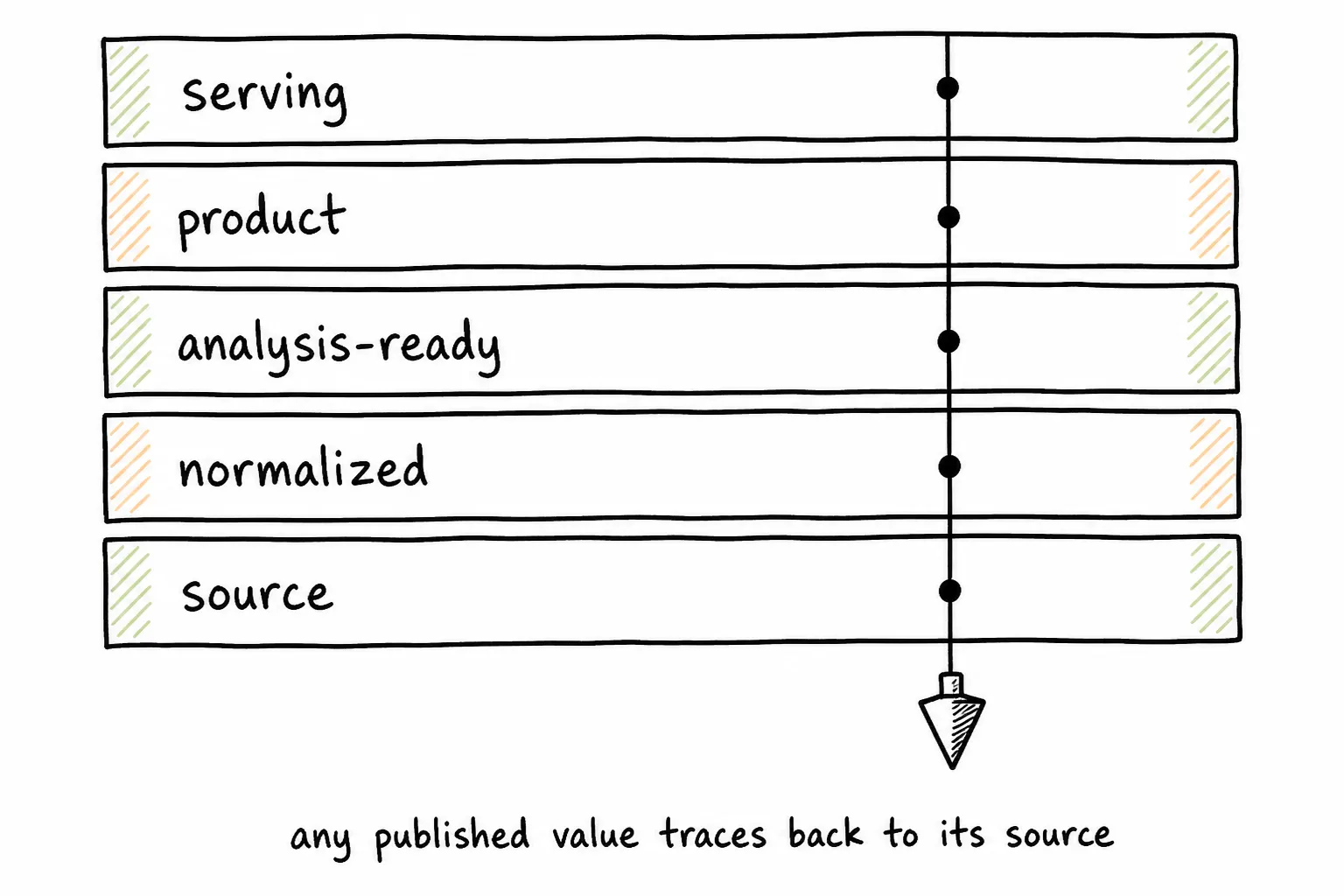
Any published value traces back through every stage to the source that produced it.
Does a geospatial lakehouse replace geographic information system software?
Desktop tools remain useful for exploration, cartography, and expert review. Raster libraries remain necessary for reprojection, resampling, tiling, and band math. Routing and topology engines remain appropriate when general data platforms lack those capabilities. The lakehouse replaces none of them: it defines how they participate in a governed production workflow.
Inputs come from controlled locations. Jobs run through orchestration. Outputs enter named tables or storage paths with lineage and quality records. Specialist capability remains available without creating an invisible parallel data estate.
What makes an implementation production-ready?
The distance between a working demonstration and a dependable product shows up in operations. A production-ready implementation has explicit owners, repeatable runs, quality gates, access controls, and supported serving paths. It records processing volume, runtime, failures, rows written, and estimated cost. Interrupted jobs can resume from completed checkpoints. Consumers know which output is current and what business meaning it carries. The common ways teams fall short of this state are covered in Why geospatial pipelines stall before production.
Performance is also workload-specific. Teams should test representative data volumes, geographic extents, coordinate systems, and query patterns. A spatial index that helps point-in-polygon queries may provide little value for large raster transformations. Platform claims do not replace benchmark results from the intended workload.
How should an organization start?
The failure mode of adoption is breadth: a platform program that tries to onboard every spatial dataset before any of them supports a decision. Start narrower than feels ambitious, with one recurring spatial decision and one pipeline serving it. Define the consumer, output grain, refresh schedule, source data, acceptance criteria, and operating owner before selecting processing tools. Preserve the source, produce one governed output, and connect that output to a real analysis or application.
This narrow scope exposes the architecture decisions that matter: where metadata lives, how work is partitioned, which quality checks block publication, and who responds when a run fails. Once those conventions are proven, the organization can reuse them across additional geospatial workloads.
About the author
Sean Knight is a serial entrepreneur in the San Francisco Bay Area who builds products and companies around AI and geospatial data. He opened his first business, a retail computer shop, at 17, then began his career as an astrophysicist. From there he moved into remote sensing and machine learning, eventually flying drones over glaciers in Alaska and New Zealand to build 3D point clouds. Today he runs LakeGeo, consults on AI, and builds AI agents that run geospatial pipelines on platforms like Databricks. Find him on LinkedIn.
See more LakeGeo in your Google Search and AI results.
Make LakeGeo a preferred source on Google